Flood Mitigation Plan Update – December 2024

Sussex is pleased to advise Sussex residents that the Flood Mitigation Initial Project Description documents for the Sussex Flood Mitigation Proposal has been submitted to the Impact Assessment Agency of Canada (IAAC). The proposed Project involves the construction of two flood diversion channels to divert flood waters away from the downtown core and residential areas of Sussex, New Brunswick into the Kennebecasis River. Initial feedback from IAAC.
For our residents information and status of our flood mitigation proposal, the Town provides public copies of our submitted IAAC documentation including:
- Executive Summary – Initial Project Description.
- IAAC Initial Project Description Submission 19-11-2024.
- Sussex Flood Diversion Channels – Climate Lens Green House Gas Calculation, 19-11-2024.
- Impact Assessment Agency of Canada (IAAC) initial feedback and Information requests, 02-12-2024
- Conformity Review of the Initial Project Description
The Kennebecasis River flows around Sussex to the southwest, while three tributaries of the Kennebecasis River, Trout Creek, Parsons Brook, and Ward Creek, flow directly through the community. Together, these four watercourses form part of the Kennebecasis Watershed.
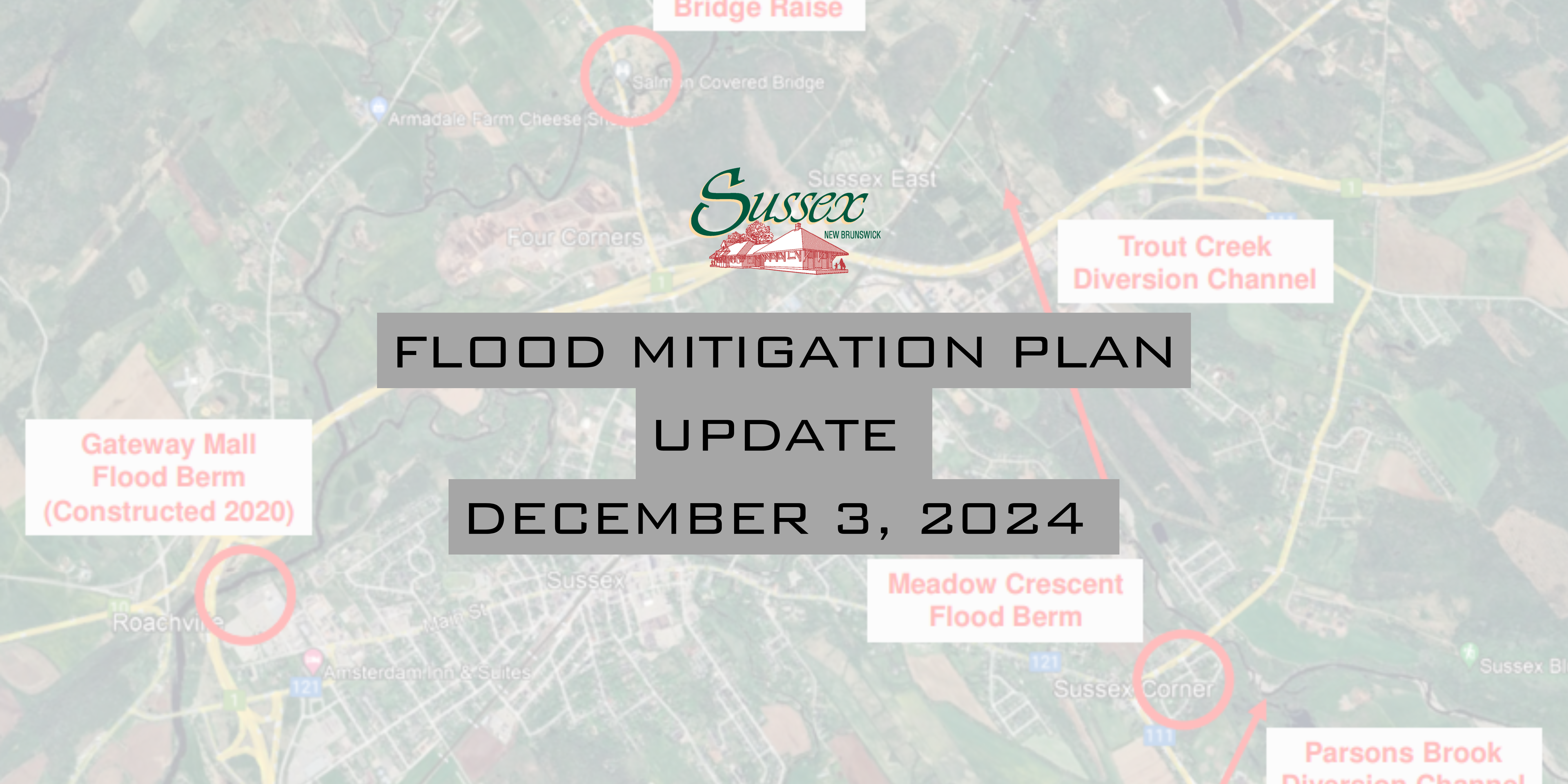
Extreme climate change-driven flooding in Sussex has caused millions of dollars in damage over the past decade. Sussex commissioned several studies and developed a Regional Flood Risk Mitigation Plan to alleviate the recurring flooding issues. As an initial step of the Mitigation Plan, a flood berm was constructed along the Kennebecasis River behind the Town’s Gateway Mall in 2019, providing flood protection for the northwestern area of the Town during the flood events of December 2020 and February 2024 and to complete the necessary prerequisite project to facilitate the future flood mitigation measures. Flood studies were conducted by the Town’s consulting engineers GEMTEC in 2022 to estimate flood levels in the Kennebecasis River and its tributaries resulting from a future (projected to the year 2100) 100-year storm event. Without additional flood mitigation measures, it was predicted that over 450 properties would be affected by this future flood event.
Our Flood Mitigation Proposal includes the optimum combination of flood mitigation measures, which are also the remaining measures to be implemented as part of the Regional Flood Risk Mitigation Plan. This will include the construction of two channels that will redirect excess flood water from Parsons Brook and Trout Creek into the Kennebecasis River. By implementing targeted flood mitigation measures, the project aims to significantly decrease the frequency, severity, and extent of flooding along Trout Creek and Parsons Brook. The project seeks to safeguard critical infrastructure, reduce property damage, and minimize disruption to the local population. These efforts are designed to enhance the long-term resilience of Sussex against future flood events.
The key components of the Project include:
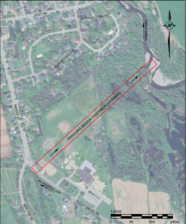
Parsons Brook Diversion Channel. A 580 metre channel extending northeast from Parsons Brook near Sussex Corner Elementary School to Trout Creek, with the discharge point located 350 metres upstream of the Post Road Bridge. The channel will pass through recreational green spaces near the school, coming within 100 metres of the building. The closest residence to the channel is 50 metres from the intake structure at the intersections within 200 m of the proposal channel.

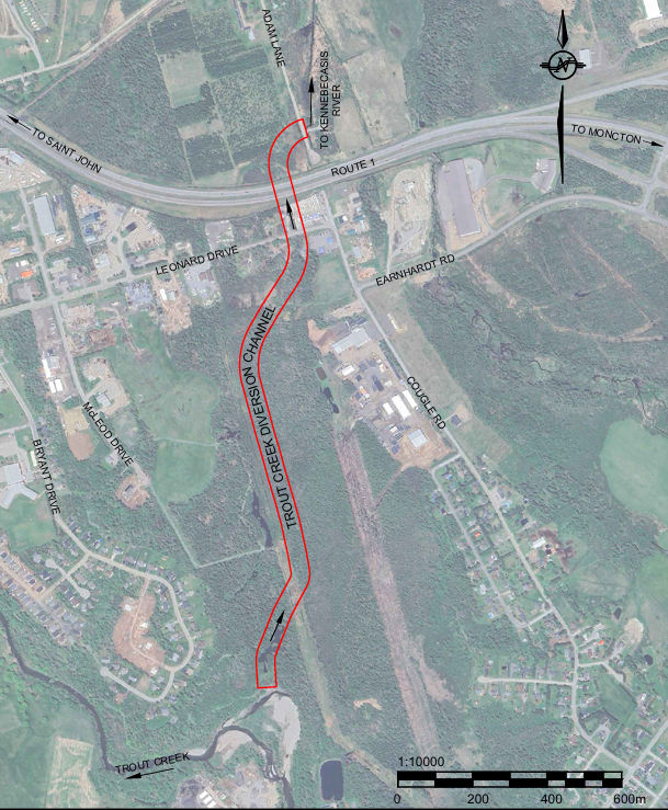
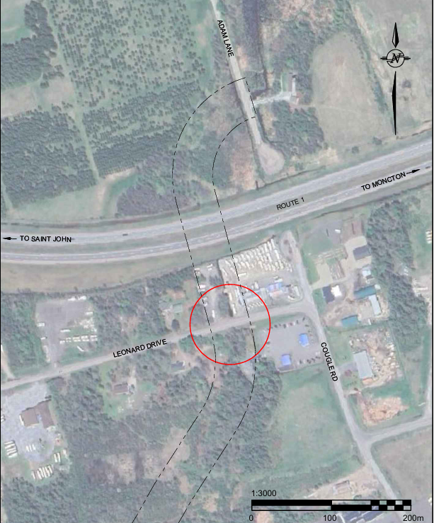
Trout Creek Diversion Channel. A 1,600 metre channel extending north from Trout Creek near Brown’s Paving Ltd. to the floodplain of the Kennebecasis River, east of Aiton Road and north of Route 1. Five homes along Bryant Drive and Canterbury close are within 200 meters of the channel’s southern end, and at Leonard Drive, the channel will be 20 to 30 meters from nearby homes.


The proposed diversion channels cross municipally-owned, provincially-owned, and privately-owned land. Other upgrades associated with the Project include the construction of two bridge/overpass structures on New Brunswick Route 1, construction of a culvert or Bridge at Leonard Drive, raising the bridge deck elevation of a section of New Brunswick Route 890 and the adjacent covered bridge, and the addition of minor flow control measures to the storm sewer system downtown Sussex.
The total cost of the project is estimated at $38.25 million, which includes $15.7 million for highway bridges on Route 1.
Funding applications to Infrastructure Canada’s Disaster Mitigation and Adaptation Fund (DMAF) was submitted for the Project in July 2023 for $15.3 million in federal funding, accounting for 40% of the project eligible costs. In addition to the request for federal funding, an application was submitted to the Provincial Government of New Brunswick under the Investing in Canada Infrastructure Program (ICIP) for just over $12.6 million, accounting for 33%. Approval for both the federal DMAF and provincial ICIP funding was received for the Project in June 2024. Sussex will cover the remaining 27% of the project cost at approximately $10.3 million by using reserved funds, borrowing, and drawing from its annual budgets during the design and construction phases.
The project is expected to take about three to five years to complete, depending on how quickly all necessary approvals are obtained. The design phase is currently underway, with details like the size of the channels, environmental considerations, and bridge specifications being finalized. This design work should be finished by 2025. Construction is planned to begin in 2026, with bridge work on Route 1 taking two years (2026 and 2027), and work on Route 890 and Leonard Drive bridges set for 2026 or 2027. The diversion channels and hydraulic control structures are also planned for construction during 2026 and 2027, with the full project expected to be operational by 2028. This project is designed to last for 80 to 100 years, providing long-term flood protection. Routine maintenance, like clearing debris and mowing, will be needed to keep the channels working efficiently, but the overall design and materials are built to ensure the channels remain effective for decades to come.
PUBLIC CONSULTATION CONTINUES:
The development of the Regional Flood Risk Mitigation Plan, and the subsequent Sussex Flood Mitigation Proposal, involved extensive consultations with landowners, businesses, government agencies, and Indigenous communities. A public meeting was also held in March 2022 to gather input. The main concerns raised during these consultations included:
- Potential increases in water levels in the areas receiving diverted floodwaters, such as parts of Trout Creek and the Kennebecasis River.
- The costs associated with building, operating, and maintaining new bridge structures, especially where the proposed flood diversion channels intersect with Route
- The need to raise the elevation of the bridge over the Kennebecasis River.
- The use of private land for the flood channels, including agreements for land sales or occupation.
Consultations with stakeholders will continue throughout the planning and implementation of the project to ensure concerns are addressed. A high-level project description was sent in June 2024 to the Chiefs of all Mi’gmaq and Wolastoqey First Nations. Specific feedback has been received from the First Nation Communities:
- Oromocto First Nation, which requested more information but had no immediate concerns.
- Peskotomuhkati at Skutik First Nation, which deferred consultation to the Mi’gmaq communities.
- Mi’gmawe’l Tplu’taqnn Incorporated (MTI), representing eight Mi’gmaq First Nations, which requested a Mi’gmaq Rights Impact Assessment (MRIA) to ensure Aboriginal and Treaty rights are considered.
The Town and GEMTEC met with MTI representatives in July 2024 to discuss archaeological concerns and agreed to have an Indigenous Monitor present during the archeological assessment. Ongoing communication and cooperation with Indigenous groups, Infrastructure Canada, and the New Brunswick Department of Indigenous Affairs will continue to ensure all concerns are addressed appropriately as we proceed further with our project development.
For further information please contact Scott M. Hatcher, P. Eng. CAO Sussex during normal business hours
Previous Flood Mitigation Plan Updates:
